
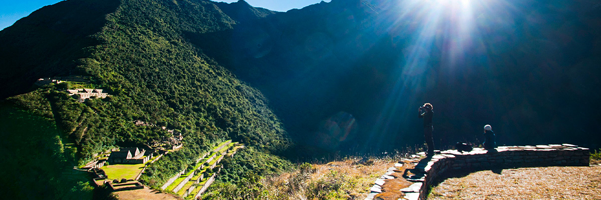
Choquequirao Trek, the so-called CRADLE OF GOLD, shows its imposing print on a hillside near the Apurimac. Its stone walls do not have the fine finish of the temples of Machu Picchu but the seal of the Incan engineers is unmistakable.
The trip usually starts with a bus or van from Cusco to the town of Cachora (Abancay), where the dusty 30 kilometer path leads to the mysterious citadel, located on top of a green and powerful mountain at 3,085 masl.
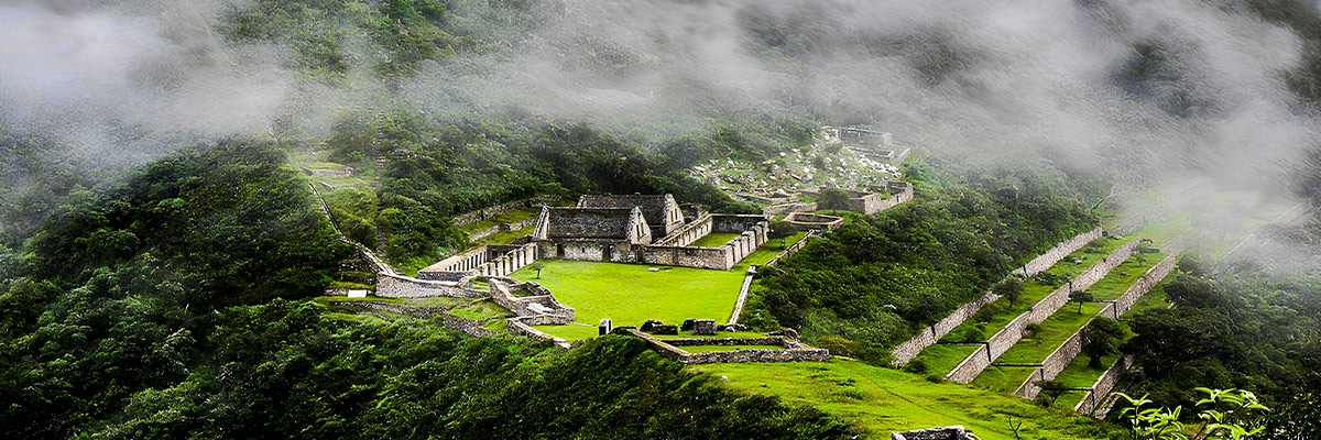
Choquequirao Peru is composed of nine sectors, among them the religious political center, the system of fountains and channels with aqueducts, and the group of covers. It is necessary to emphasize the religious character of this complex. The architecture is distributed around an “esplanade” or main square, and is complemented by a very well preserved Andean agricultural system. The archaeological remains are distributed in the descending part of Choquequirao hill and are grouped as small districts, somewhat separated from each other, following a probable criterion of function and social rank.
The complex is located in a low mountain area or jungle eyebrow, northwest of the Apurimac Canyon. It houses a particular ecology, which is characterized by abundant vegetation. The warm climate - typical of the area - alternates with cold temperatures from altitude, which contributes to the diversity of flora and fauna. The Incas exploited these geographical conditions prodigiously.
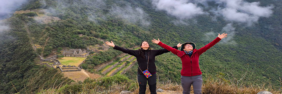
While the journey is a long one, for the growing and overwhelming numbers of people who love challenges, it will be everything that is expected. Without a doubt, an experience that you will never forget!
Choquequirao is located in the district of Santa Teresa, province of La Convención in the department of Cusco. The archaeological complex is located 47 km from the village of Cachora on the Choquequirao mountain beloging to the Salkantay mountain range, on the right bank of the Apurimac River.
Note: This trek is recommended for people in good physical condition, as daily climbs can be steep and quite difficult, and the scarcity of water in the first few days will make the hours that are scheduled daily even more difficult. We also suggest to tourists to carry a fairly strong insect repellent since in this area there are lots of mosquitoes and mosquitoes for being a jungle “eyebrow” or a quite tropical area.
The trip to Choquequirao is long and strenuous, but certainly unforgettable. It leaves from Cusco by the road that goes to Abancay. At kilometer 154 you should take the detour to the town of Cachora, the last village before arriving at the archaeological complex. From there one goes on horseback or on foot. In Cachora you can hire the services of the horses to carry the load. The road has been recently expanded and arranged, so travel along it is now more comfortable and safe. Getting to Choquequirao requires a good physical condition and the right equipment. Starting from Cachora (2,900 masl) it is necessary to go down to the Apurimac River (1,530 masl) to camp. The second day is up to 3,085 masl of altitude, where the complex is located. To return, the same path is used.
The days have an average duration of five to six hours each day. The steep slopes along the route, as well as the dramatic variation of the climates along the route, make it a demanding but well rewarded trip.
The facilities that serve as accommodation for archaeologists and workers, maintain a small area that functions as an office and deposit of objects found during the excavation. The visitor can request to see the latest findings. It is almost impossible to reach Choquequirao during the rainy season (December to March). In addition, the archaeological work is interrupted this season.
It is advisable to bring an abundant amount of water, rehydrating salts and water purification tablets. It is also very important to bring your original passport for corresponding controls.
Choquequirao Tour is an emblem of the Incan resistance that unfolds its colossal stone walls on top of a mountain. Discovering its cyclopean beauty is a fascinating adventure, exhausting and unforgettable, in which you have to overcome a path that travels the edge of a landscape of snowy remoteness and persistent greenery.
The excursions to Choquequirao, this distant archaeological complex - called the other Machu Picchu, because of its historical importance and the architectural style of its stone walls - are usually started with a bus or van from Cusco to the town of Cachora (Abancay).
In the different stages of the crossing to Choquequirao, the following places must be visited:
The quiet village of Cachora attracts travelers with the tranquility of its streets and the rusticity of its houses. In this typical Andean community, with its modest plaza and its flawless church, the road begins to Choquequirao, characterized by its long slopes, its steep descents, the distant presence of the snowy Ampay and Salcantay Mountains, and the profoundness of the Apurimac Canyon, one of the deepest on the planet.
Some points of interest in the 30 km (60 round trip) route are:
This is a quiet area, ideal for resting or camping, which has a water intake. It is located 16 kilometers from Cachora (14 from Choquequirao).


